


All horse trails in the United States


Ready to explore the best equestrian trails near you? Equilab offers thousands of riding routes for scenic strolls, endurance training, and more. Discover verified trail maps to find the perfect path for your next adventure, and then track your ride – all using the world's best horse riding app.
Most popular trails


Super nice. No bugs.


rocky, lots of creek crossing

2 hill sets, lots of walking
Beautiful & lots of trotting


Started a tracker at the last half hour of the ride. Probably closer to about 6 miles what we did and made it a loop - comp lot:Hard pack, some Rocky some just Lightly covered with sand. Slight incline and decline. Gone through a couple washes, lovely trail. Some road crossings.

Not a big incline. You ride past the slash piles.


Take Donna’s hit Buttery Fly Spur. Head up the 2000 road to JR’s trail, Tennis Shoe on the clear cut. Head up Jack Sims. Turn right onto the logging road, walk a bit and then hit Dry Creek. You’ll ride through two creeks. Take Freemont’s Fav to Josh’s Holler, Camp 3 to Donna’s.
Trail ride to the Little Store
Over the bridge, back via gamelands
Must be a member of Ride Fauquier

Bridges Creek woods fields and hills
Go to Wendy’s
Endurance 25 mile ride loop

Great camping and riding

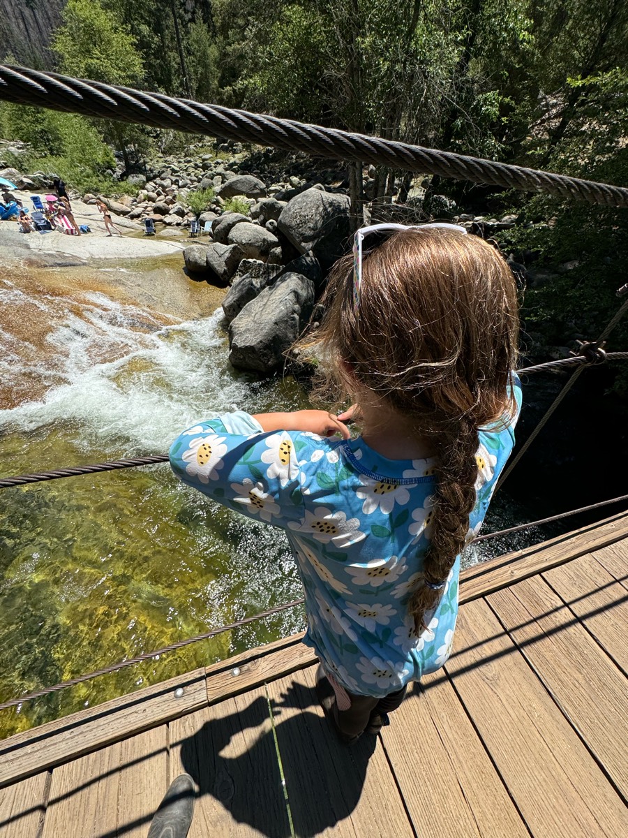
The first half is on the road and the second half is a wonderful sandy trail with little foot (or hoof!) traffic, leading to the swinging bridge where you can climb down for a dip if your horses are nice enough to wait for you:)
1369 Cedar Springs Rd, Bradley, SC 29189Bathrooms and water for horses. Need bucket and hose.Some riding on side of the road.
Loop around York Trail and vineyard.

Nice trail but some low hanging branches.. need to bring a saw. Also a bicycle trail

Public park, miles of trails


Got the whole trail
Only hard part is 2 step ups on rocks on the climb to the overlook.
Guest Ride Extraordinaire


Beautiful. Varied footing, all good.
Wet trail # 30 past old graveyard, pond trail 28

3rd Loop of Iron Mountain on Friday
My Blue house & back

Lots of bridges and good spots to trot

Easy 2 track trail, light gravel on some roads, several downed trees that have to be skirted.

Very mixed terrain in the Arizona desert. Can be dry or include water crossings, depending on the season. Busy on weekends.

Lots of water, muddy, gravel road to gait


Sandy. Minimal rocks. Small hills
New path on the farm side of the power line trails, lots of twists and turns instead of straight.

Got lost and hit dead end
Standard loop, easy out and can run home if wanted. Nice fun little ride.

Fence line up then across hiline then packers bridge n cut off loop to parking lot
Technically difficult with multiple water crossings with steep drops and narrow board crossings. Requires strong trail horse.
VERY rocky, narrow, overgrown. Difficulty rating is like 8/10 to me.
Grindstone Lake fishermans Trail loop.
Deer trail had a lot of moguls
Some rocks lots of hills and washes

Dropped Sean off at the bar and ponied Nova
Lots of hikers and dogs

Beautiful, rocky and challenging in areas. This is not a beginner horse/ rider trail. The scenery is breathtaking. A good trail to bring a lunch, snacks and plenty of water for yourself if the weather is hot. There are some shallow stream crossings for horses to drink.

Nice trail but a bit rocky. Boots or shoes would be a good idea. View from the upper trail is spectacular and the lower trail follows the river.
Around the hills, up the hills, some water crossings
Joder Ranch off trail, around the mountain.

Mix of hills, narrow trails and flat riding
Generally flat with one decent hill to climb. Exposed roots and some rocky areas.
Forest Road 435 is all sand
Easy wide trails.
Hippie cave, House Bluff, Mill Seat, Tarkiln


Very quiet trail around farm fields and a small lake pretty much all grass
I picked him up at his house. Didn’t turn on Eq until almost there

Elk Rock State Park 50,000 acres, around 10 miles of trails. Hiking and equestrian campground available. Lots of equestrian traffic. Narrow trails with minimal rock.
All trails in the United States
Ready to explore the best equestrian trails in the United States? Equilab offers thousands of riding routes for scenic strolls, endurance training, and more. Discover verified trail maps to find the perfect path for your next adventure, and then track your ride – all using the world's best horse riding app.
FAQ about Equilab trails
You can explore these trails and many more within the Equilab app! Simply download the app onto your mobile device, create an account, and then head to the “Track” tab. There you can view thousands of trails to discover and ride.
No, Equilab empowers equestrians everywhere to discover and ride trails for free! By creating an account within the app (no payment needed), you will be able to see and ride all public trails. Our Premium subscription offers great additional features, which you can learn more about here.
You can control the visibility of any trails you create using Equilab by selecting different privacy options when saving the trails. If you choose to make a trail "Public", it will be visible here on our website and to anyone using the app. Private trails, on the other hand, are only visible to you and (if you're a Premium user) anyone you share them with. Note: If you rode on private property, we strongly recommend saving your trail as "Private".
Equilab’s list of trails currently only includes those that have been tracked by riders using the Equilab app. As a result, there are still many trails not yet included in our platform. Anyone can track trails and add them for free, however — giving you the chance to help others discover new places to ride!
Yes! You can add a trail from any ride you track using the Equilab app. To so, simply download the app, create an account, then record your ride on the trial.
Note that to create a trail, the ride must be at least 0.6 miles long, have taken at least 5 minutes, and must not have been tracked within an arena.
Our community members have added more than 35,000 public trails, and new ones are added every day. We hope you enjoy exploring them!

Contact our team
Feedback & Help
support@equilabapp.com
Press and Partnerships
marketing@equilabapp.com
Business Inquiries
admin@equilabapp.com


