


All horse trails in the United States


Ready to explore the best equestrian trails near you? Equilab offers thousands of riding routes for scenic strolls, endurance training, and more. Discover verified trail maps to find the perfect path for your next adventure, and then track your ride – all using the world's best horse riding app.
Most popular trails


Way longer than this. Had to stop at 3.5 miles due to down tree.
Mostly flat with good footing
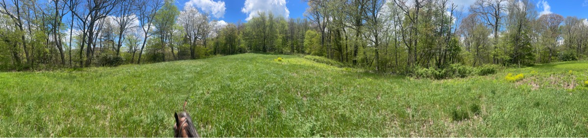
Delaware & Lehigh Trail starting in Bowmanstown
Ride to PCH and back home
Paved road only
Not marked for trail riding at all. We rode on hunting trails and around fields
10 mile loop through the creeks

Beautiful double lane trail. Very uphill and rocky. Would highly suggest shod or booted horses on this trail. No water and desert like conditions. Several cattle guards, you can go around them but some have gates.
Some shelf rocks and hills but a lot of flat too
3.3 mile gravel pipeline
Easy trail down the trailer park
Nice trail slightly technical with occasional wash outs (all of the washouts have an easy path around) lots of water crossings from puddles all the way to a small river. Mild hill climbs and mild descends. Trail is mainly dirt with larger rocks that you can work around.

Pleasant for a nice hack

To picnic tables and back
Pioneer Trail to deer Creek Loop
Third ride and learned new trail connections

Nice 2.5 hour ride not much more than 5 miles
Percy Warner Park Equestrian Trail
Mendon Ponds Park - Short loop.

Steep challenging terrain
Easy loop for a walk or faster ride. About half an hour at a walk

Hard with rocks. Atv, side by sides, trucks and motorcycles you will run into out there. Everyone has been very nice and slows way down to pass me and the dogs.


Easy to intermediateRoots, hills, and rocks (single riding width)
Beautiful trail but your horse needs to be in shape. Big hill climbs. There are several asphalt road crossings and one section where you have to walk along a short stretch of asphalt bike trail. Some trails are rocky in places.
Turned around on Rosebriar but full Moonlit Vista


Parrie Haynes Equestrian Ranch
Fun ride but don't reccomend the cemetery trail

Final segment of Trinity Trail Highland North starting from Wild Estate boarding pasture.


Ride from Cook Forest to Clarion River
Powerline trail mixed with wooded area.. spots
One of the many loops that can be taken. The Creekside trail is one way due to it being a narrow trail with a few drop offs

Fun beautiful trail with mixed footing
Easy some water crossing

Faith ranch down malito

Old railway converted to walking, biking and riding trails

Very flat partially though town.
Lots of roots, unkept trails

Hard rocky trail into the lake. Beautiful breathtaking views. Park at the horse camp for better parking

Great trail to a couple of hills, lots of fun!
Beautiful desert scenery. Rocky in places.
One of the horse trails at Standing Indian Park in the smoky mountains
Blue > White > Yellow
Level, great footing, mostly shaded


Beautiful sandy trails in the Sandhills

Multiple surfaces mostly sunny with some shade.
Ride from Gillespie ranch to the working pens and back. Add .4 miles since I forgot to turn on the tracker at the barns
Staged in Leonard. Road block.
5 miles with D


Some deep sand, hills, flats, horse trails cross bike trails, connects to other trailheads.
Horsemen's to Donnie's, out around lake, old lookout, and new lookout

Lots of dogs barking, a few horse pastures.
Dreams Stepping stone trail

Pretty ride along the river

Cross the river twice, mixed footing, road riding at times
All trails in the United States
Ready to explore the best equestrian trails in the United States? Equilab offers thousands of riding routes for scenic strolls, endurance training, and more. Discover verified trail maps to find the perfect path for your next adventure, and then track your ride – all using the world's best horse riding app.
FAQ about Equilab trails
You can explore these trails and many more within the Equilab app! Simply download the app onto your mobile device, create an account, and then head to the “Track” tab. There you can view thousands of trails to discover and ride.
No, Equilab empowers equestrians everywhere to discover and ride trails for free! By creating an account within the app (no payment needed), you will be able to see and ride all public trails. Our Premium subscription offers great additional features, which you can learn more about here.
You can control the visibility of any trails you create using Equilab by selecting different privacy options when saving the trails. If you choose to make a trail "Public", it will be visible here on our website and to anyone using the app. Private trails, on the other hand, are only visible to you and (if you're a Premium user) anyone you share them with. Note: If you rode on private property, we strongly recommend saving your trail as "Private".
Equilab’s list of trails currently only includes those that have been tracked by riders using the Equilab app. As a result, there are still many trails not yet included in our platform. Anyone can track trails and add them for free, however — giving you the chance to help others discover new places to ride!
Yes! You can add a trail from any ride you track using the Equilab app. To so, simply download the app, create an account, then record your ride on the trial.
Note that to create a trail, the ride must be at least 0.6 miles long, have taken at least 5 minutes, and must not have been tracked within an arena.
Our community members have added more than 35,000 public trails, and new ones are added every day. We hope you enjoy exploring them!

Contact our team
Feedback & Help
support@equilabapp.com
Press and Partnerships
marketing@equilabapp.com
Business Inquiries
admin@equilabapp.com


