


All trails in the United States


Ready to explore the best equestrian trails in the United States? Equilab offers thousands of riding routes for scenic strolls, endurance training, and more. Discover verified trail maps to find the perfect path for your next adventure, and then track your ride – all using the world's best horse riding app.
Most popular trails


Ones at the end of the road on Eden ave Hudson Fl

Mostly logging road type trail. Multi use. Lots of fishing and archery. Parking lot is hit or miss, small trailers recommended. Shooting range and clay shooting field nearby, with monthly shoots. Hunters typically are in orange and respectful. Dogs off leash are allowed.
Wide 2 track up Santan up to rocky single track Stargazer then over to open 2 track Moonlight then connect to 2 track San tan and head back on 2 track service toad

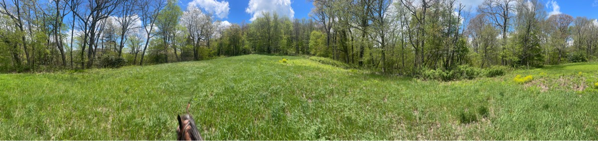
An easy trail, with a mix of open fields and woods. There may be hikers and bikes
Did lots of water crossings and switch backs with hills!
A combination of hills, washes and road. Recommend shoes as it is rocky

River Canal horse trails
This trail follows the white/red arrows. The full trail is about 6.7 miles.
Nice easy ride along the river.

Wooded hills, truck trails
Mix of trails and road. Not accessible in the summer due to bugs.
Sandy, gently rolling trails. Nice River access
Mt Pisgah trail ride around the lower half of the summit
One of the horse trails at Standing Indian Park in the smoky mountains

Beautiful, rocky and challenging in areas. This is not a beginner horse/ rider trail. The scenery is breathtaking. A good trail to bring a lunch, snacks and plenty of water for yourself if the weather is hot. There are some shallow stream crossings for horses to drink.
Easy park trail around lake Rita Blanca
Relaxing trail along the river
High cliff state park south trail


Nice 2.5 hour ride not much more than 5 miles

Easy ride through from nearby boarding like VH ranch to boarding facilities off Happy camp
Mostly trail, some brush and hill on norconian. Good ride
Trail from pasture. Rode towards central valley, then to stecoah, then the yellow trail

Old railroad bed turned into a trail. Trail goes from athens to Englewood. Plenty of trailer parking at athens. Trail is shared with bicyclists, joggers, and walkers. Easy trail with 2 easy and safe rail bridge crossings and a couple road crossings. Trail is flat and open.
good parking, lots of gravel but mixed with softer ground, one road crossing
Guided Equestrian Rides - Reservations Required
Fun ride but don't reccomend the cemetery trail
Saw mill trail head to grindstone stable. Like a roller coaster ride. Lots of up and down.
Garnet mine loop with some east crossroads and water tower. To tunnel and back to trailhead.

Easy sandy . Woods

east gate out of parking lot.
Residential horse trails
Switchback to Park then 125 Bridge and Conduit
Nice trail thru woods with moss

One section of trails
Absolutely.Gorgeous, it was shady, it was quiet and just out of the way, but absolutely perfect

Intermediate/ challenging trail , rocky , Ôøº narrow , views on ridge
Kit Carson from Jackson
Looping trail with bridges
Light-moderate trail with plenty of hills, some easy open bridges and stream crosses. Field riding also available
Trying to find the fields, but didn’t
Good hill climb good view
One small hill, pretty rocky, not a lot of great areas for long stints of trot and canter.

Woods, fields, dirt tanks. and seasonal wetlands
Sandy trail . Wooded. Need to cross a road
Devils canyon pretty views mostly road
Moderate. Good footing. Lots of hills.

Ride past the prettiest parts of horse country on mostly private land graciously kept open by each owner üíóüíó

Easy footing but some climbing

17 mile route used for AERC Greenland Endurance Ride
20 mile ride. No shoes needed on the horses.
Little rocky in spots, some small hills.
Straight up; skirt around little baldy. May have downfall pending the season. Pass the guzzler deer tank ü¶å
Sandy . Wooded cow path trails
Mixed, encountered yellowjackets

Combination of multiple trails equaling about 6.5 out and back. Shaped kinda like a lollipop.


Nice trail out in Red Canyon. Hill is steep and rocky for 1/4 mile. Road back is nice footing
All trails in the United States
Ready to explore the best equestrian trails in the United States? Equilab offers thousands of riding routes for scenic strolls, endurance training, and more. Discover verified trail maps to find the perfect path for your next adventure, and then track your ride – all using the world's best horse riding app.
FAQ about Equilab trails
You can explore these trails and many more within the Equilab app! Simply download the app onto your mobile device, create an account, and then head to the “Track” tab. There you can view thousands of trails to discover and ride.
No, Equilab empowers equestrians everywhere to discover and ride trails for free! By creating an account within the app (no payment needed), you will be able to see and ride all public trails. Our Premium subscription offers great additional features, which you can learn more about here.
You can control the visibility of any trails you create using Equilab by selecting different privacy options when saving the trails. If you choose to make a trail "Public", it will be visible here on our website and to anyone using the app. Private trails, on the other hand, are only visible to you and (if you're a Premium user) anyone you share them with. Note: If you rode on private property, we strongly recommend saving your trail as "Private".
Equilab’s list of trails currently only includes those that have been tracked by riders using the Equilab app. As a result, there are still many trails not yet included in our platform. Anyone can track trails and add them for free, however — giving you the chance to help others discover new places to ride!
Yes! You can add a trail from any ride you track using the Equilab app. To so, simply download the app, create an account, then record your ride on the trial.
Note that to create a trail, the ride must be at least 0.6 miles long, have taken at least 5 minutes, and must not have been tracked within an arena.
Our community members have added more than 35,000 public trails, and new ones are added every day. We hope you enjoy exploring them!

Contact our team
Feedback & Help
support@equilabapp.com
Press and Partnerships
marketing@equilabapp.com
Business Inquiries
admin@equilabapp.com


